Landsat-9 OLI-2 Satellite Imagery Map
Landsat 9 is a partnership between the U.S. Geological Survey (USGS) and the National Aeronautics and Space Administration (NASA) and continues the Landsat program’s critical role of repeat global observations for monitoring, understanding, and managing Earth’s natural resources. Landsat 9, launched on September 27, 2021, at 1:12PM CST from Vandenberg Air Force Base, California, onboard a United Launch Alliance Atlas V 401 rocket. Landsat 9 carries the Operational Land Imager 2 (OLI–2), built by Ball Aerospace & Technologies Corporation, Boulder, Colorado, and the Thermal Infrared Sensor 2 (TIRS–2), built at the NASA Goddard Space Flight Center, Greenbelt, Maryland. Northrop Grumman designed and fabricated the spacecraft and integrated the two instruments.

Source: U.S. Geological Survey (USGS), EarthExplorer. https://earthexplorer.usgs.gov/
Tags
Drainage Density Map Drainage Network Map Geological Map - Formation Geological Map - Lithology Geomorphological Map Groundwater Flow Direction (Pre-Monsoon) Groundwater Flow Direction (Post-Monsoon) GroundWater Fluctuation Map v2 Landform Classification Map v2 LandUseLandCoverMap 2011 LandUseLandCoverMap 2021 LULC Map for Year 2011 and 2021 River and Lake Link Map Satellite Imagery Map 2011 Satellite Imagery Map 2021 Soil Map v2 Unconfined Aquifer Map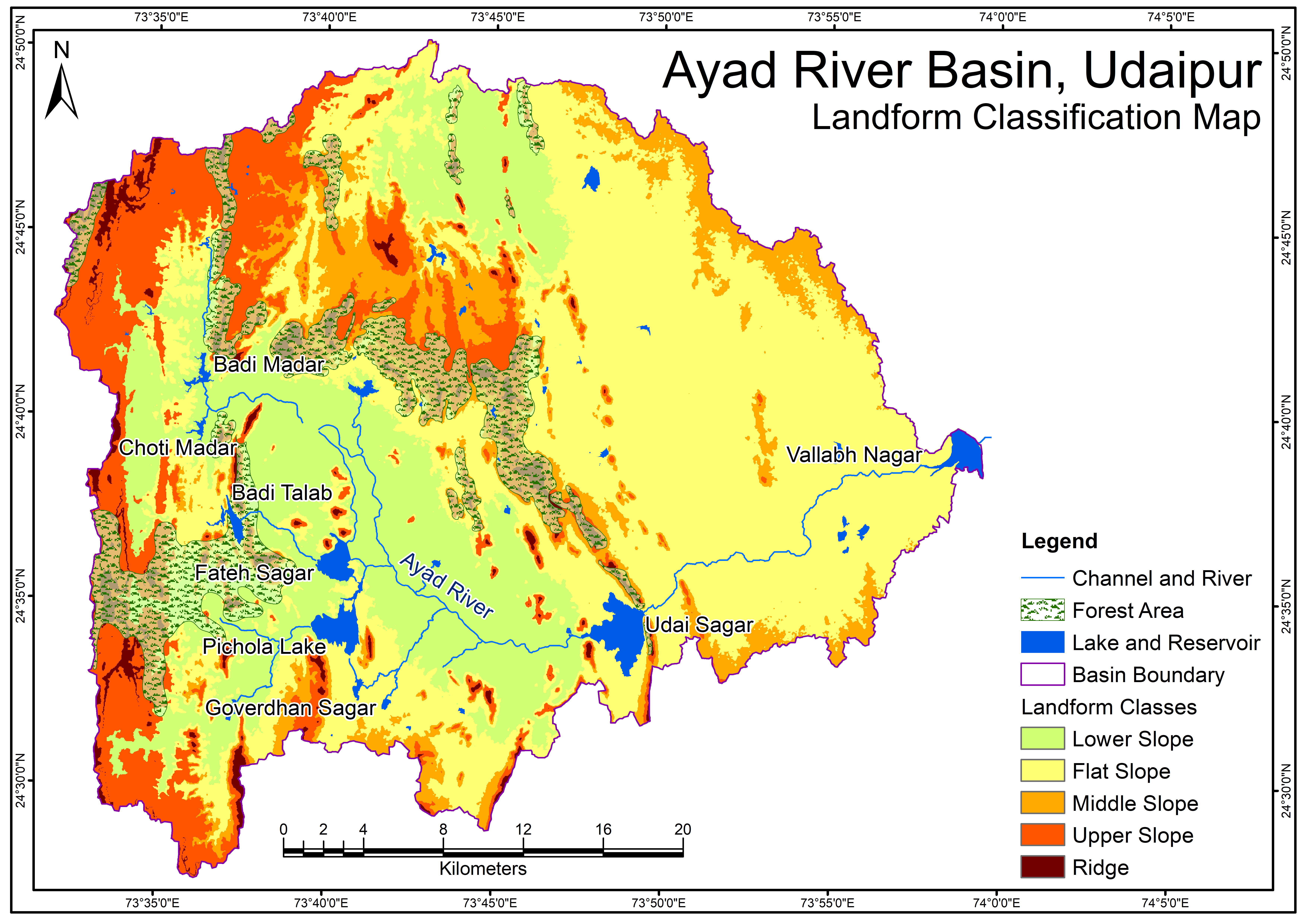
Related images
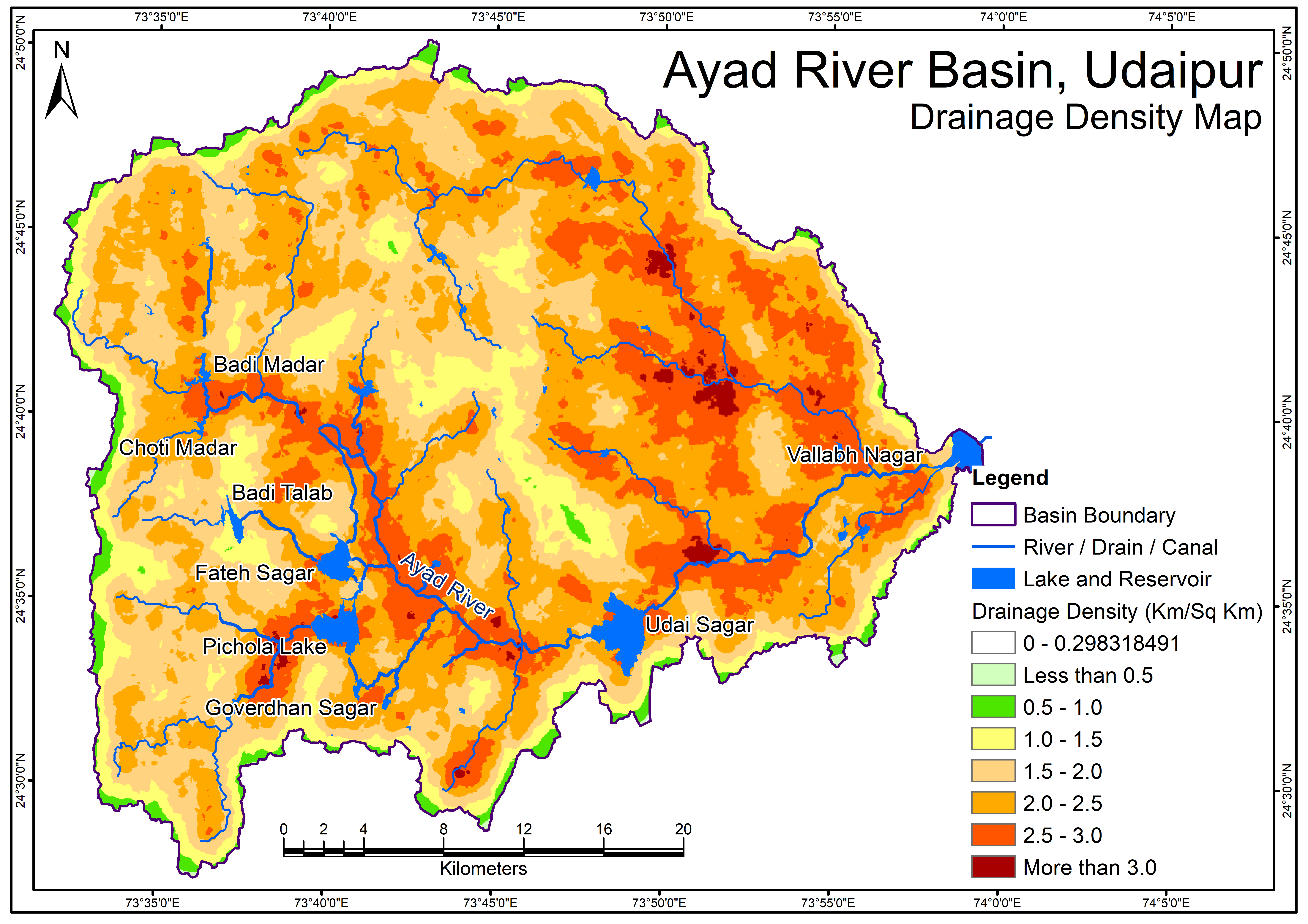
Drainage Density Map
View more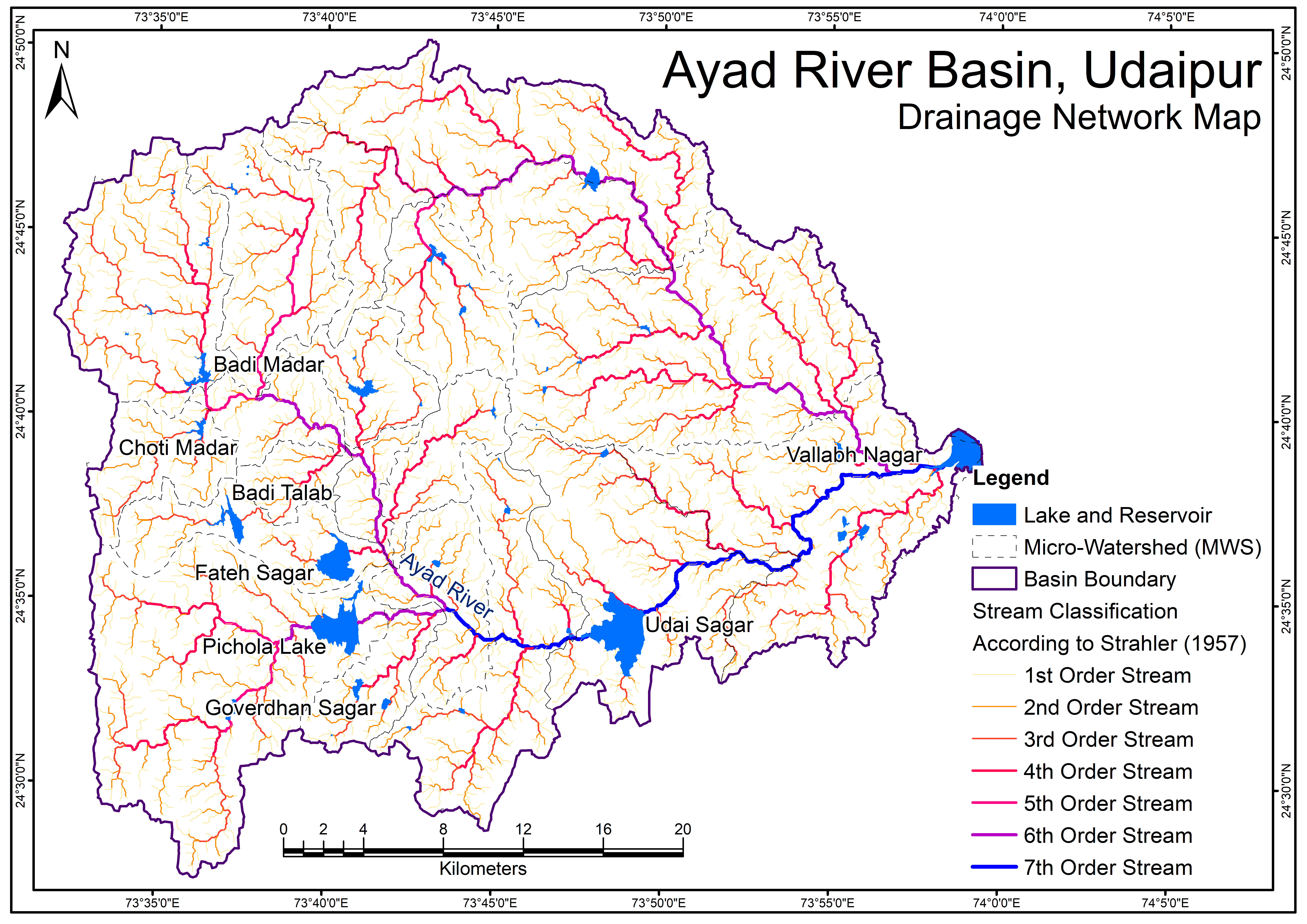
Perfumes
Drainage Network Map
Geological Map - Formation
View more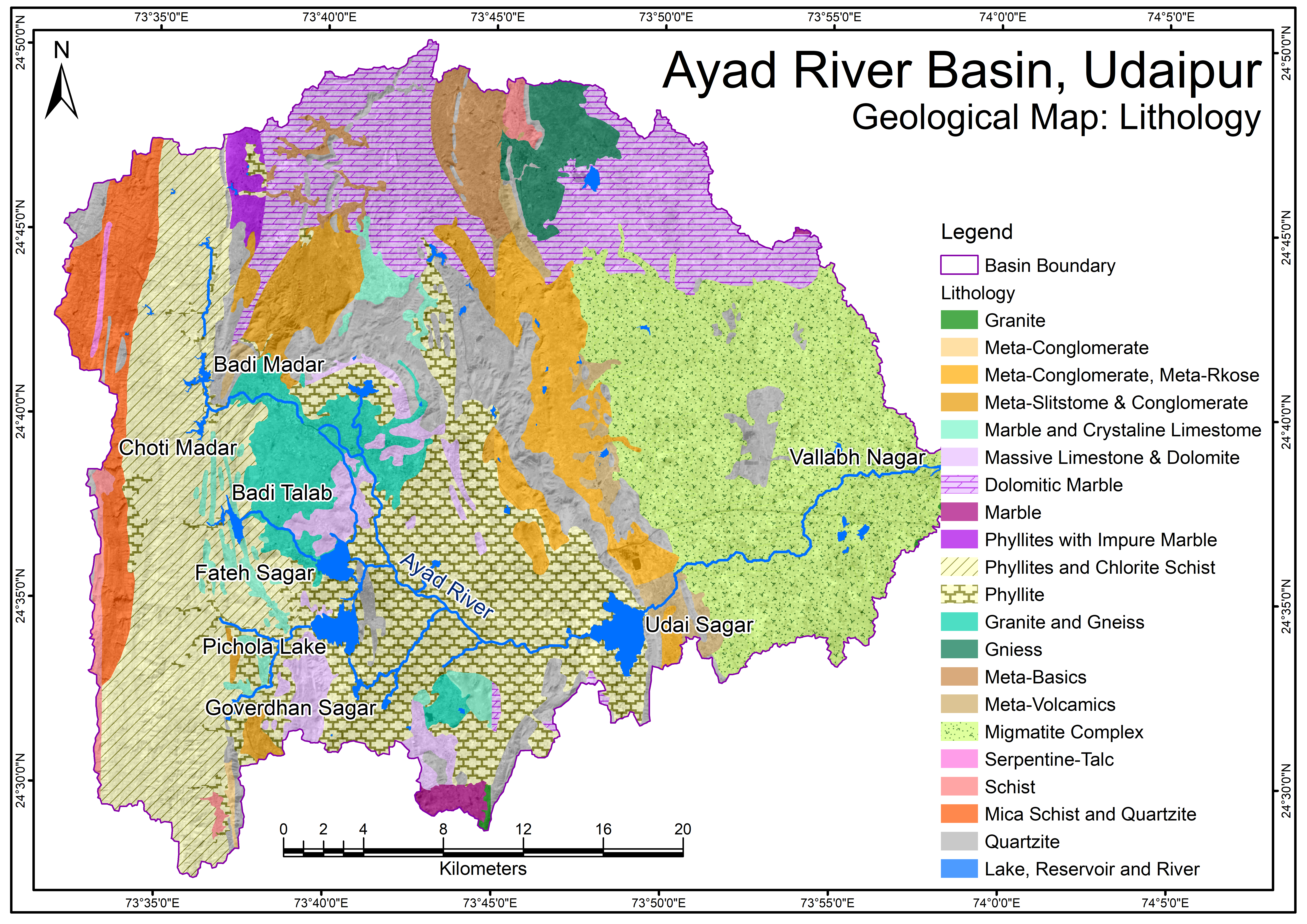
Geological Map - Lithology.png
View more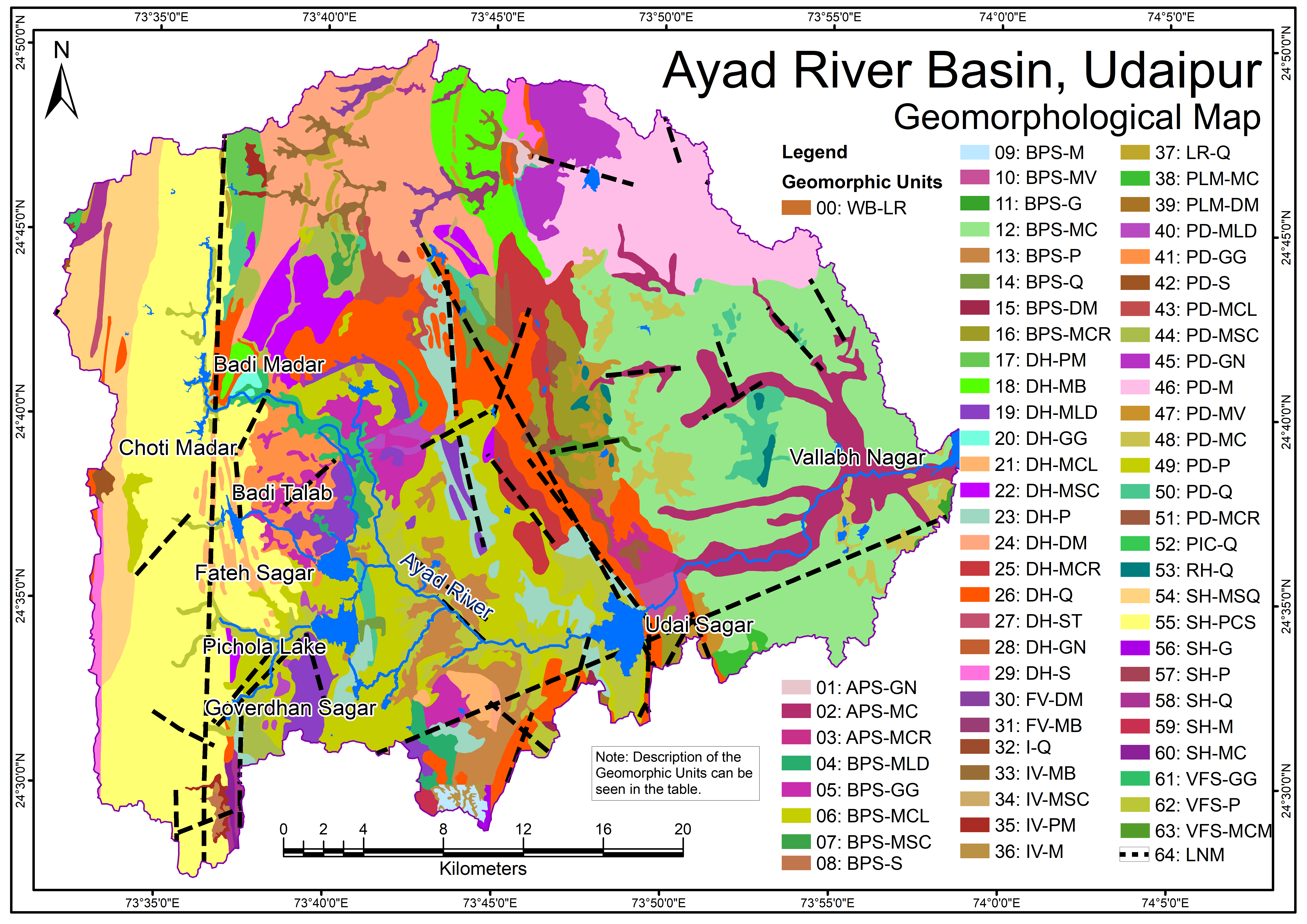
Geomorphological Map
View more.png)
Groundwater Flow Direction (Pre-Monsoon)
View more.png)
Groundwater Flow Direction (Post-Monsoon)
View more